Sign In
Logout
Account
Cart
SEARCH
Help?
Why do we use cookies?
Privacy Policy/Disclaimer
Home
Product Categories
Educational Materials
Fact Sheets
Geologic Publications
Topographic Maps
Virginia Minerals
Publication 001: Bibliography of Virginia geology and mineral resources - 1960-1969
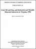
Publication 095: Coal, oil and gas, and industrial and metallic minerals industries in Virginia, 1986-1987
Publication 002: Geology of the Blairs, Mount Hermon, Danville, and Ringold Quadrangles, Virginia
Publication 096: Geology of the Keen Mountain quadrangle, Virginia
Publication 003: Geology of the Waynesboro East and Waynesboro West Quadrangle, Virginia
Publication 097: Geology of the Grundy Quadrangle, Virginia
Publication 004: Geology of the Greenfield and Sherando Quadrangles, Virginia
Publication 098: Geology of the Virginia Portion of the Harman and Jamboree Quadrangles
Publication 005: Geology of the Omega, South Boston, Cluster Springs, and Virgilina Quadrangles
Publication 099: Geology of the Virginia portion of the Patterson, Bradshaw and War quadrangles
Publication 006: Bouguer gravity in southwestern Virginia
Publication 100: Energy resources and facilities in Virginia
Publication 007: Contributions to Virginia Geology - III
Publication 101: Travertine-marl: stream deposits in Virginia
Publication 008: Geology of the Norfolk North quadrangle, Virginia
Publication 102: Geologic Map of Clarke County, Virginia and Map of Selected Hydrogeologic Components for Clarke County, Virginia
Publication 009: Geology of the Norfolk South quadrangle, Virginia
Publication 103: Heavy mineral studies - Virginia Inner Continental Shelf
Publication 010: Geology of the Grottoes Quadrangle, Virginia
Publication 104: Evaluating the impact of multi-seam mining on recoverable coal reserves in an adjacent seam
Publication 011: Geology of the Mount Sidney Quadrangle, Virginia
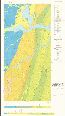
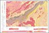
Publication 105: Physiographic Diagram of Virginia
Publication 012: Geology of the Fort Defiance Quadrangle, Virginia
Publication 106: Geology of the St. Paul and Carbo Quadrangles, Virginia
Publication 013: Geology of the Crimora Quadrangle, Virginia
Publication 107: Geology and Mineral Resources of the Boswells Tavern and Keswick Quadrangles, Virginia
Publication 014: Geology of the Blacksburg Quadrangle, Virginia
Publication 108: Analyses of carbonate rocks - northern Virginia
Publication 015: Geologic factors affecting land modification in Warren County, Virginia
Publication 109: Geology of the coal-bearing portion of the Richlands quadrangle, Virginia
Publication 016: Geology of the Abingdon, Wyndale, Holston Valley, and Shady Valley Quadrangles
Publication 110: Geology of the Coal-bearing Portion of the Tazewell North, Tip Top, and Gary Quadrangles, Virginia
Publication 017: Geology of the Massies Corner quadrangle, Virginia
Publication 111: Coal resource estimate for Lee County, Virginia
Publication 018: Geology of the Bon Air Quadrangle, Virginia
Publication 112: Gold Mineralization, and Tin, Base Metals, and Thorium Anomalizes at Yankee Horse Ridge, Irish Creek Tin Area, Rockbridge County, Virginia
Publication 019: Gold in Virginia
Publication 113: Oil and Gas Well Data and Geology for Lee County, Virginia
Publication 020: Geology of the Oak Grove core
Publication 114: Coal, oil and gas, and industrial and metallic minerals industries in Virginia, 1988-1989
Publication 021: Geology of the Whitmell and Brosville quadrangles, Virginia
Publication 115: Tantalian and Niobian Resources in Virginia
Publication 022: Geology of the Axton and Northeast Eden quadrangles, Virginia
Publication 116: Stratigraphy of the Waynesboro Formation (Lower and Middle Cambrian) near Buchanan, Botetourt County, Virginia
Publication 023: Geologic Structure and Hydrocarbon Potential along the Saltville and Pulaski Thrusts in Southwestern Virginia and Northeastern Tennessee
Publication 117: Structure of the Bane dome, Giles County, Virginia - a gravity test
Publication 024: Simple Bouguer gravity anomaly map of the Culpeper basin and vicinity, Virginia
Publication 118: Available coal resource study of Appalachia 7.5-minute quadrangle, Virginia-Kentucky
Publication 025: Geology of the Willis Mountain Quadrangle, Virginia
Publication 119: Proceedings - 26th Forum on the geology of industrial minerals
Publication 026: Geology of the Andersonville quadrangle, Virginia
Publication 120: Bibliography and index of Virginia geology, 1970 - 1979
Publication 027: Contributions to Virginia Geology - IV
Publication 121: Geology of the Virginia portion of the Hurley, Panther, Wharncliffe and Majestic quadrangles
Publication 028: Lineament and Fracture Trace Analysis and Its Application to Oil Exploration in Lee County, Virginia
Publication 122: Coal Sample Analyses From the Southwest Virginia Coalfield
Publication 029: Geologic investigations in the Willis Mountain and Andersonville quadrangles, Virginia
Publication 123: Bibliography and index of Virginia geology, 1980 - 1989
Publication 030: Geology of the Hanover Academy Quadrangle, Virginia
Publication 124: The Valley Coalfield (Mississippian Age) in Montgomery and Pulaski Counties, Virginia
Publication 031: Geology of the Glen Allen quadrangle, Virginia
Publication 125: Coal, oil and gas, and industrial and metallic minerals industries in Virginia, 1990
Publication 032: High-silica resources in Augusta, Bath, Highland, and Rockbridge Counties, Virginia
Publication 126: Reinterpretation of Rocklandian (Upper Ordovician) K-bentonite stratigraphy in southwest Virginia, southeast West Virginia, and northeast Tennessee, with a discussion of the conglomeratic sandstones in the Bays and Moccasin formations
Publication 033: Analyses of Coal Samples Collected 1975-1977
Publication 127: Pliocene Molluscs from the Yorktown and Chowan River Formations in Virginia
Publication 034: Geology of the Roanoke and Stewartsville Quadrangles, Virginia
Publication 128: Coal, oil and gas, and industrial and metallic minerals industries in Virginia, 1991
Publication 035: Geology of the Villamont and Montvale Quadrangles, Virginia
Publication 129: Directory of the Mineral Industry in Virgina - 1993
Publication 036: Virginia clay material resources
Publication 130: Catalogue of Fieldtrip Guidebooks and Road Logs for Virginia
Publication 037: Valley and Ridge stratigraphic correlations, Virginia
Publication 131: Geology and Mineral Resources of the Southwest Virginia Coalfield
Publication 038: A vein-type uranium environment in the Precambrian Lovingston Formation, central Virginia
Publication 132: Studies in Eastern Energy and the Environment
Publication 039: Bibliography of Virginia coal
Publication 133: Coal, oil and gas, and industrial and metallic minerals industries in Virginia, 1992
Publication 040: Total-count aeroradiometric contour map of the Culpeper basin and vicinity, Virginia
Publication 134: Geology of the Simeon quadrangle, Virginia
Publication 041: Aeromagnetic contour map of the Culpeper basin and vicinity, Virginia
Publication 135: Analyses of Carbonate Rocks - Northwestern Virginia (Elkins-Staunton 0.5 Degree x 1 Degree Quadrangles)
Publication 042: Stratigraphic cross sections for the Upper Mississippian - Middle Pennsylvanian units of Buchanan and Dickenson counties, southwest Virginia
Publication 136: Coal Beds, Coal Zones, and Key Stratigraphic Names in the Pennsylvanian Units of Southwestern Virginia
Publication 043: Relationship of Stratigraphy to Occurrences of Oil and Gas in Western Virginia
Publication 137: Geology and Mineral Resources of Henry County and the City of Martinsville, Virginia
Publication 044: Selected karst features of the northern Valley and Ridge province, Virginia
Publication 138: Geologic Map of Warren County, Virginia
Publication 044: Selected Karst Features of the Northern Valley and Ridge Province, Virginia
Publication 139: Coal, oil and gas, and industrial and metallic minerals industries in Virginia, 1993
Publication 045: Virginia Gold Resource Data
Publication 140: Structural Section Across the Atlantic Coastal Plain, Virginia and Southeasternmost Maryland
Publication 046: Coal-bed Methane Resource Evaluation Montgomery County, Virginia
Publication 141: Bibliography and Index of Virginia Geology, 1990-1994
Publication 047: Simple Bouguer gravity anomaly map of the Farmville, Briery Creek, Roanoke Creek, Randolph, and Scottsburg basins and vicinity, Virginia
Publication 142: Coal, oil and gas, and industrial and metallic minerals industries in Virginia, 1994
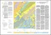
Publication 048: Geologic map of the Spring Garden quadrangle, Virginia
Publication 143: Geologic Map of Clarke, Frederick, Page, Shenandoah, and Warren Counties, Virginia: Lord Fairfax Planning District
Publication 049: Geologic Map of the Pittsville and Chatham Quadrangles, Virginia
Publication 144: Geology, Natural Gas, Oil, and Other Mineral Resources of Wise County, Virginia
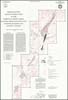
Publication 050: Wells drilled for natural gas in Buchanan County, Virginia
Publication 145: Composite Devonian and Lower Mississippian Section Near Norton, Virginia
Publication 051: Selected Virginia mineral-resource information
Publication 146: Coal, oil and gas, and industrial and metallic mineral industries in Virginia, 1995
Publication 052: Geology of the Prater and Vansant quadrangles, Virginia
Publication 147: Metallic Mines, Prospects and Occurrences in the Gold-Pyrite Belt of Virginia
Publication 053: Simple Bouguer gravity anomaly map of the Richmond and Taylorsville basins and vicinity, Virginia
Publication 148: Geologic Map of the Roanoke 30 X 60-minute Quadrangle
Publication 054: Coal Resources Data on Federal Lands in Virginia
Publication 149: Virginia's Coal Ages
Publication 055: Geologic Features Related To Coal Mine Roof Falls – A Guide For Miner Training
Publication 150: Coal, oil and gas, and industrial and metallic minerals industries in Virginia, 1996
Publication 056: Eden in peril: The troubled waters of the Chesapeake Bay
Publication 151: Coal, oil and gas, and industrial and metallic minerals industries in Virginia, 1997
Publication 057: Post-Martinsburg Ordovician stratigraphy of Virginia and West Virginia
Publication 152: Early Eocene Vertebrates and Plants from the Fisher/Sullivan Site (Nanjemoy Formation) Stafford County, Virginia
Publication 058: Simple Bouguer gravity anomaly map of the Danville-Dan River basin and vicinity, Virginia-North Carolina and the Scottsville basin and vicinity, Virginia
Publication 153: Coal, oil and gas, and industrial and metallic minerals industries in Virginia, 1998
Publication 059: Geology of the Southwestern Virginia Piedmont
Publication 154: Geology of the Glasgow and Buena Vista Quadrangles, Virginia with Cross Sections and Structural Maps
Publication 060: Geology of the Harrisonburg and Bridgewater Quadrangles, Virginia
Publication 155: Geologic Map of the Virginia Portion of Elkins 30 x 60-minute Quadrangle
Publication 061: Thomas Jefferson and American Vertebrate Paleontology
Publication 156: Geologic Map of the Virginia Portion of the Peterstown Quadrangle
Publication 062: Minerals for Virginia
Publication 157: Bedrock Geology of the Madison Quadrangle, Virginia
Publication 063: Analyses of Virginia Coal Samples Collected 1978-1980
Publication 159: Geologic Map of the Augusta, Page, and Rockingham Counties Portion of the Charlottesville 30 x 60-minute Quadrangle
Publication 064: Geology of the Ashland Quadrangle, Virginia
Publication 160: Geologic Map of the Virginia Portion of the Lindside Quadrangle
Publication 065: Geology of the Norton Quadrangle, Virginia
Publication 161: Geologic Map of the Virginia Portion of the Winchester 30 X 60-minute Quadrangle
Publication 066: Part 1: Interpretive seismic profile along Interstate I-64 in central Virginia from the Valley and Ridge to the Coastal Plain
Publication 162: Geologic Map of the Front Royal 30 x 60-minute Quadrangle: Portions of Clarke, Page, Rockingham, Shenandoah, and Warren Counties, Virginia
Publication 067: High-silica resources in Alleghany, Botetourt, Craig, and Roanoke counties, Virginia
Publication 163: Geologic Map of the Virginia Portion of the Staunton 30 X 60-minute Quadrangle
Publication 068: Clay-material samples collected 1981-1984
Publication 164: Directory of the Mineral Industry in Virginia - 2001
Publication 069: Geologic Map of Giles County, Virginia
Publication 165: Geologic Map of the Western Portion of the Richmond 30 X 60-minute Quadrangle, Virginia
Publication 070: Selected Slope Categories and Karst Features Map of Giles County, Virginia
Publication 166: Geologic map of the Virginia portion of the Danville 30 x 60 minute quadrangle
Publication 071: Geology of the Virginia Portion of the Flat Gap Quadrangle
Publication 166: Geologic Map of the Virginia Portion of the Danville 30 X 60-minute Quadrangle
Publication 072: Geology of the Virginia portion of the Appalachia and Benham quadrangles
Publication 167: Selected Karst Features of the Southern Valley and Ridge Province, Virginia
Publication 073: Geology and petroleum potential of Mesozoic and Cenozoic rocks, offshore Virginia
Publication 169: Geologic Map of the Virginia Portion of the Lewisburg 30 x 60-minute Quadrangle
Publication 074: Contributions to Virginia geology, V
Publication 170: Geology of Rockbridge County, Virginia
Publication 075: The Quaternary of Virginia - A Symposium Volume
Publication 171: Digital Representation of the Geologic Map of the Virginia Portion of the Winchester 30x60-minute Quadrangle
Publication 076: Clay material testing program, 1957-1986
Publication 172: Geology of the Damascus and Laurel Bloomery Quadrangles, Virginia
Publication 077: Geology of the Sandy Level and Callands quadrangles, Virginia
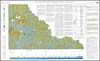
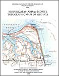
Publication 173: Historical 15- and 30-minute Topographic Maps of Virginia
Publication 078: Geochemistry and radioactivity in the Powhatan area, Virginia
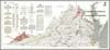
Publication 174: Digital Representation of the 1993 Geologic Map of Virginia
Publication 079: Geology of the East Stone Gap Quadrangle, Virginia
Publication 175: Digital Reprint of T. L. Watson’s 1907 Mineral Resources of Virginia
Publication 080: Geology of the Wise Quadrangle, and the Coal-bearing Portion of the Fort Blackmore Quadrangle, Virginia
Publication 176: Early attempts of English mineral exploration in North America: The Jamestown Colony
Publication 081: Geology of the Coeburn Quadrangle and the Coal-bearing Portion of the Dungannon Quadrangle, Virginia
Publication 177: Geology of the Lakeside Village Quadrangle, Virginia
Publication 082: Coal, oil and gas, and industrial and metallic minerals industries in Virginia, 1985
Publication 178: Geology of the Monterey Quadrangle, Virginia
Publication 083: Selected Karst Features of the Central Valley and Ridge Province, Virginia
Publication 179: Geologic map of the Swift Run Gap quadrangle, Virginia
Publication 084: Geology of the Pound and Caney Ridge Quadrangles, Virginia
Publication 180: Geologic map of the Alberene quadrangle, Virginia
Publication 085: Mining History of the Richmond Coalfield of Virginia
Publication 182: Geology of the Tunstall quadrangle, Virginia
Publication 086: Geology of the Virginia Portion of the Clintwood and Jenkins East Quadrangles
Publication 183: Geologic map of the Pulaski quadrangle, Virginia
Publication 087: Geology and mineral resources of the Brandon and Norge quadrangles, Virginia
Publication 184: Geologic Map of the Cornwall Quadrangle, Virginia
Publication 088: Contributions to the geology of Virginia - VI
Publication 185: Seismic History of Virginia
Publication 089: Minerals of Albemarle County, Virginia
Publication 186: Geologic Map Of The Timberville Quadrangle, Virginia
Publication 090, Part A: Geologic map of the Rocky Mount and Gladehill quadrangles, Virginia
Publication 187: Geology of the Catawba Quadrangle, Virginia
Publication 090, Part B: Geologic map of the Penhook and Mountain Valley quadrangles, Virginia
Publication 188: Geologic Map of the White Gate Quadrangle, Virginia
Publication 090, Part C: Geology of the Rocky Mount, Gladehill, Penhook, and Mountain Valley quadrangles, Virginia
Publication 189: Geology of the Mineral and Lake Anna West Quadrangles, Virginia
Publication 091: Geology of the Haysi Quadrangle, Virginia
Publication 190: Geology of the Saltville and Broadford Quadrangles, Virginia
Publication 092: Geology of the Nora quadrangle, Virginia
Publication 191: Economic, Radiochemical, and Stable Isotope Constituents in Formation Waters Produced From Coalbed Methane Wells in Buchanan County, Virginia
Publication 093: Copper, Lead, and Zinc Resources in Virginia
Publication 192: Geologic map of the Dabneys quadrangle, Virginia, 1:24,000-scale
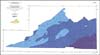
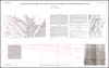
Publication 094: Exposed and Inferred Early Mesozoic Basins Onshore and Offshore, Virginia
Publication 193: Geologic map of the Long Spur quadrangle, Virginia, 1:24,000-scale

 Sign In
 Account
 Cart
Cart