
|
Your Price: $0.00
Model
Number: 2879
|
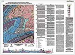
By A.P. Schultz, M.J. Bartholomew, E.K. Brown, G.R. Ingram, S.E. Lewis, and J.A. Blair, 32.5- x 44.5-inch color 1:24,000-scale geologic map, 2015. This map of the Pulaski 7.5-minute quadrangle in Pulaski and Wythe Counties, Virginia shows the distribution of Paleozoic-age sedimentary rocks and Cenozoic-age surficial deposits in map and cross-section. The characteristics of each map unit are described and a short discussion of the local geology is included. The locations of major faults, folds, quarries, and prospects are shown on the map. Online only.
|
|