
|
Your Price: $0.00
Model
Number: 3019
|
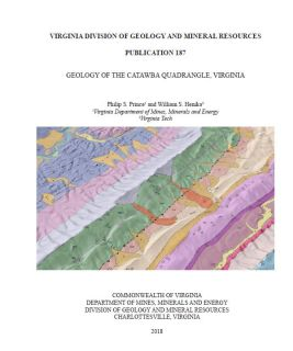
Geology of the Catawba Quadrangle, Virginia, by P.S. Prince and W.S. Henika, 2018. 8.5 x 11 inch report, 20 pages/15 figures, with folded 34.25 x 38 inch geologic map plate. Geologic map and text describe stratigraphy, structure, and economic geology of the Catawba 7.5-minute quadrangle of Roanoke, Botetourt, and Craig counties. Map area includes New Castle, Virginia and McAfee Knob, a well-known landmark on the Appalachian Trail. Two geologic cross sections show interpretations of subsurface geology based on outcrop data. Text includes discussion historical coal and iron mining along the Catawba Branch (Pulaski) Fault, with old mine workings and prospects plotted where identified. Text figures include several combined geologic map/digital topography overlays to compare bedrock outcrop pattern to topography. Available online only.
|
|