
|
In Stock
Your Price: $9.25
Model
Number: 1073

|
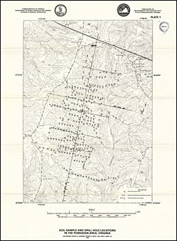
by Jan Krason, S.S. Johnson, P.D. Finley, and J.D. Marr, Jr., 60 pages, 9 plates, 29 figures, 16 tables, 1988. Anomalous radioactivity from thorium and uranium was detected in a 1974 aeroradiometric survey in an area of crystalline rocks in the Piedmont, just southwest of Powhatan, Virginia. To assess the uranium potential and possible environmental problems that might be caused by the radioactivity of the Powhatan anomalies, detailed geologic, geochemical, and ground radiometric surveys of a 3.8-square-mile area were cone during 1976 through 1978. The geochemical survey included samples of soil, stream sediment, and rock outcrops analyzed for uranium, thorium, cobalt, vanadium, and molybdenum. Eleven samples were analyzed for gold. Total-count ground radioactivity readings defined a distinct northeastward-trending linear anomaly on the axis of the Goochland anticline. In 1986, two core holes were drilled at sites where high ground radioactivity had been measured in 1976 to 1978, and confirmed in 1986. The holes were cored to depths of 140 and 160 feet; and analyzed for as many as 49 elements. Additional soil, stream gravel, and water samples were also collected in 1986. The surveys and analyses indicate the radioactivity is mainly caused by thorium present in monazite within the Maidens gneiss. The radiometric anomaly that lies along the crest of the Goochland anticline suggests structural control of the surface distribution of the zone enriched in monazite, which was then probably concentrated in the residual soil and in stream sediments after weathering of the gneiss.
|
|
|
|
Customers who bought this also bought
|
Publication 089: Minerals of Albemarle County, Virginia
|
Publication 090, Part A: Geologic map of the Rocky Mount and Gladehill quadrangles, Virginia
|
Publication 090, Part B: Geologic map of the Penhook and Mountain Valley quadrangles, Virginia
|
Publication 090, Part C: Geology of the Rocky Mount, Gladehill, Penhook, and Mountain Valley quadrangles, Virginia
|
Publication 092: Geology of the Nora quadrangle, Virginia
|
|
|
|