
|
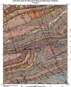
Publication 193: Geologic map of the Long Spur quadrangle, Virginia, 1:24,000-scale
|
|
|
Your Price: $0.00
Model
Number: 3124
|
By P.S. Prince, 39 x 55-inch color 1:24,000-scale geologic map, 2025. This map of the Long Spur 7.5-minute quadrangle in Bland, Pulaski, and Wythe Counties, Virginia shows the distribution of Paleozoic-age sedimentary of the Pulaski, Cove Mountain, and Saltville thrust sheets in map and cross-section. Modern alluvium, river terrace, and slope deposits are also shown. Online only.
|
|
|
|