Hurricane Helene: Landslide Mapping 2025-2026
In September 2024, Hurricane Helene swept through southwestern Virginia causing severe flooding and numerous landslides. While western North Carolina bore the brunt of the storm, an initial assessment of post-storm satellite imagery and reports from media, emergency management, and the Virginia Department of Transportation indicated that nearly 40 landslides occurred in southwestern Virginia. Grayson County, Virginia, along the border of North Carolina, was particularly hard hit. Preliminary rainfall estimates from the National Weather Service indicate that Grayson County received between 8-11 inches of rain during a 72-hour period ending September 28, 2024.

Debris slide along the New River resulting from flooding caused by Helene. (Adams, S.C., 2024).
In response to the resulting damage from Helene, Virginia Energy geologists completed a detailed inventory of landslide features (both modern and ancient) for Grayson County. No regional landslide hazard maps exist for this part of Virginia, so landslide risk was entirely unknown. The intention of this landslide inventory map is to advance the understanding of geological and topographic factors that influence landslide initiation and the risk to public safety from landslides in southwestern Virginia.
Virginia Energy received funding in 2025 from the U.S. Geological Survey to complete a landslide hazard mapping study in Grayson County as a response to Hurricane Helene (G25AP00227-01).
Study Area
Grayson County is in the Blue Ridge geologic province and is underlain by Proterozoic igneous and metamorphic rocks. This part of Virginia was hit by county-wide flash flooding in January 1996 and three consecutive days of heavy rain and catastrophic flash flooding brough on by Hurricane Helene in September 2024, resulting in over $51 million in property and crop damage (NOAA, 2026).
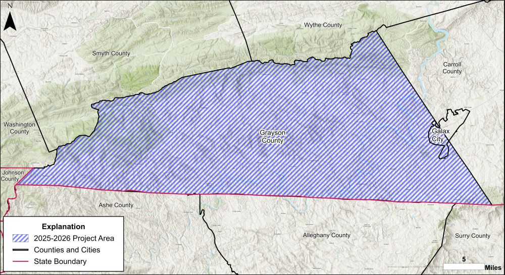
Grayson County project area in Virginia, along the border with North Carolina to the south and Tennessee to the southwest.
Methods
This project was completed as follows:
- Remote sensing: Preliminary identification of modern and ancient landslide features using 1-meter resolution lidar basemaps and digital aerial imagery.
- Geologic field mapping: Selected landslide features were targeted for detailed field mapping using the preliminary lidar and aerial imagery interpretation.
- Map product: Based on field observations, interpretations of modern and ancient landslide features were updated in the project geodatabase. Results were compiled into a county-scale inventory map and deliverable geodatabase

Debris slide in western Grayson County.
Deliverables
An inventory of modern and ancient landslides was developed for the Grayson County mapping project and delivered to the U.S. Geological Survey in September 2026. The GIS files and a PDF inventory map are available for download as ZIP files and are described below.
Landslide Geodatabase (ZIP file containing an ArcGIS geodatabase):
This ZIP file contains an ESRI ArcGIS geodatabase containing point and polygon feature classes representing known landslide initiation zones (points), slope movement outlines (polygons), and slope movement deposit outlines (polygons). Landslide data was compiled up until the year 2026 (more recent failures will not be included). Please see the metadata for detailed descriptions of each feature class.
Landslide Inventory Map (PDF):Slope Movement and Slope Movement Deposits Map of Grayson County, Virginia. This map illustrates the extent and distribution of known historical slope movements and pre-existing slope movement deposits mapped within the study area
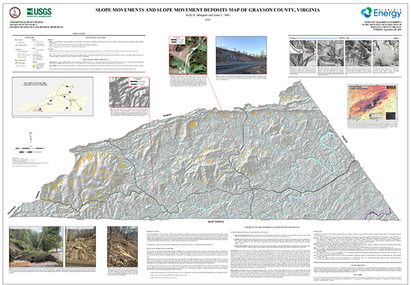
Thumbnail images of inventory map.
Acknowledgement:
This material is based upon work supported by the U.S. Geological Survey under Grant No. G25AP00227-00.
Disclaimer:
The views and conclusions contained in this document are those of the authors and should not be interpreted as representing the opinions or policies of the U.S. Geological Survey. Mention of trade names or commercial products does not constitute their endorsement by the U.S. Geological Survey.
Other resources
Landslide Inventory of Albemarle and Nelson Counties (Geology and Mineral Resources)
Landslides in Virginia (Geology and Mineral Resources)
USGS Information about Hurricane Helene
USGS Preliminary Landslide Inventory for Hurricane Helene (Sept 2024)
Insights into Widespread Landsliding in Southern Appalachia from Hurricane Helene
Selected References:
Adams, S.C., 2024, photograph, Old River Lane, Grayson County, Virginia. Retrieved from https://www.facebook.com/photo/?fbid=10230419921435639&set=pcb.10230419859074080.
National Oceanic and Atmospheric Administration (NOAA). Storm events database, National Centers for Environmental Information. Available online: https://www.ncei.noaa.gov/stormevents/, accessed 30 June 2026.