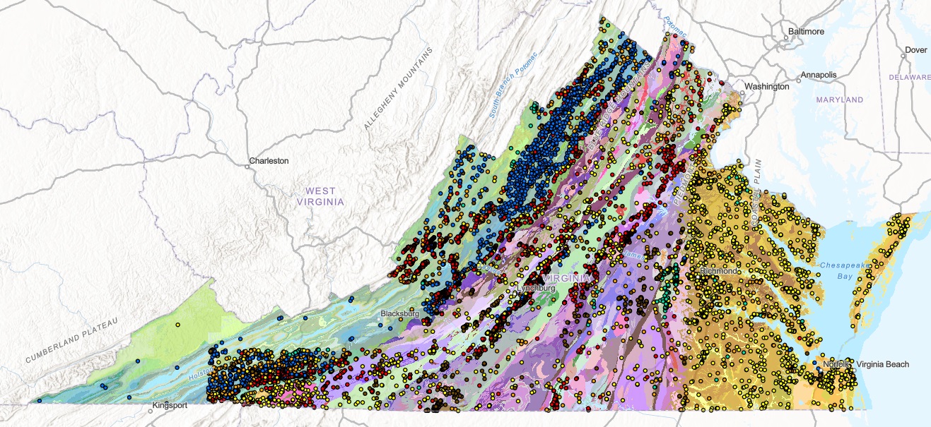
The Mineral Resources of Virginia (MRV) Program oversees the inventory of mineral occurrences, prospects, mines, quarries, and other mining and processing sites of base and precious metals, industrial minerals, and energy resources in the Commonwealth of Virginia. The resulting information is formatted for inclusion in the MRV database.
The value of the MRV database includes a multitude of functions and uses:
- Preserves key information about mineral occurrences, prospects, mines, oil and gas extraction sites, and mineral and energy processing sites in a digital archive;
- Supports public safety and environmental investigations;
- Provides a readily assessable resource for land-use decision makers;
- Provides a research tool for geological studies, resource assessments, and mineral deposit modeling and analysis;
- Enables our staff to provide timely and accurate responses to inquires from Federal, State, and local government, educators, and the general public.
Approximately ninety percent of the Commonwealth has been inventoried in the initial format of the MRV database, which included a mapped location with a site name, commodities, type of site (mine, prospect or occurrence), repository number, and literature references. With the commencement of the Wytheville 0.5° by 1° project area initiative in 2003, additional types of data were collected and recorded and another stage in the evolution of the database began.
A significant improvement is the addition of digital imagery for each site. A picture can convey a vast amount of information about a mine site and mining methodology. A digital site image is collected for each site, as are available historic images, which are digitized. For some very large sites, a segment of a low-altitude aerial photograph is digitized. The set of assessment attributes has been significantly upgraded during the inventory of the Wytheville project area. In addition to digital imagery, enhancements include the incorporation of GPS technology and additional specific data-fields.
The expanded 2003 data collection format includes additional fields from an intermediate phase of the MRV database: geologic formation, rock type, mine status (active, inactive, abandoned, etc.), site visit date, mine name history, as well as additional new data-fields. New data-fields include: the mine district, feature dimensions, accessory minerals, deposit characterization (strata unit or subunit, surficial unit, hydrothermal deposit, etc.), strike and dip, site lead (initial information source), reference citing (expanded beyond agency reference), ID number, date site opened, latitude and longitude in decimal degrees, elevation, GPS qualifier (accuracy key for type of GPS data or other type of coordinate calculation method), published illustration (figure, diagram, or map), production data, production era, Orphaned Lands classification, LA abrasion (500 cycles) data, absorption data, specific gravity, and mineral resource classification (construction material, industrial rock or mineral, metallic, energy resource).