Abandoned Mines - Greater Richmond Area
Abandoned Mine Land (AML) in Virginia is primarily focused in southwest Virginia, where mining of the Allegheny Plateau is large scale and extensive. However, the first area to be mined commercially for coal in the state of Virginia was an area just west of the city of Richmond that includes portions of Powhatan, Chesterfield, Goochland, and Henrico Counties. Although active coal mining operations no longer exist anywhere in the Greater Richmond area, the relics of past coal mining activity still mark the landscape. While some coal mining related features are rather benign, others present a serious hazard to the public, and many of the features are located in areas of rapid commercial and residential growth. The goal of the AML program in the Richmond Coalfield is to locate these abandoned coal mining features and to reclaim those which present hazards to the health and safety of the public and environment.
Chapter 706 of the Virginia Acts of Assembly (2006) is legislation which requires the seller of any new dwelling in Planning District 15 to disclose in writing to the purchaser whether they have knowledge of previous mining on the property, or the presence of abandoned mines, shafts, or pits.
How do you know if there is an abandoned coal mine feature on or near your property? The interactive GIS map below shows known locations of abandoned coal mine features state wide, including the Richmond area. Note that Virginia Energy's abandoned mine land database is being continuously updated with additional information as inventory and reclamation projects progress. Updates to the interactive map are made concurrently as data is added or edited by field personnel. While AML staff strive to make this map as comprehensive as possible, it is possible and likely that not every abandoned mine has or can be located. In some areas of historic coal mining, where commercial or residential development has occurred in the last 50 years, it is probable that some features have been concealed by construction activities or structures and are no longer able to be field located.
Abandoned Mine Land Interactive Map
AML Program in the Richmond Area
Inventory and Mapping
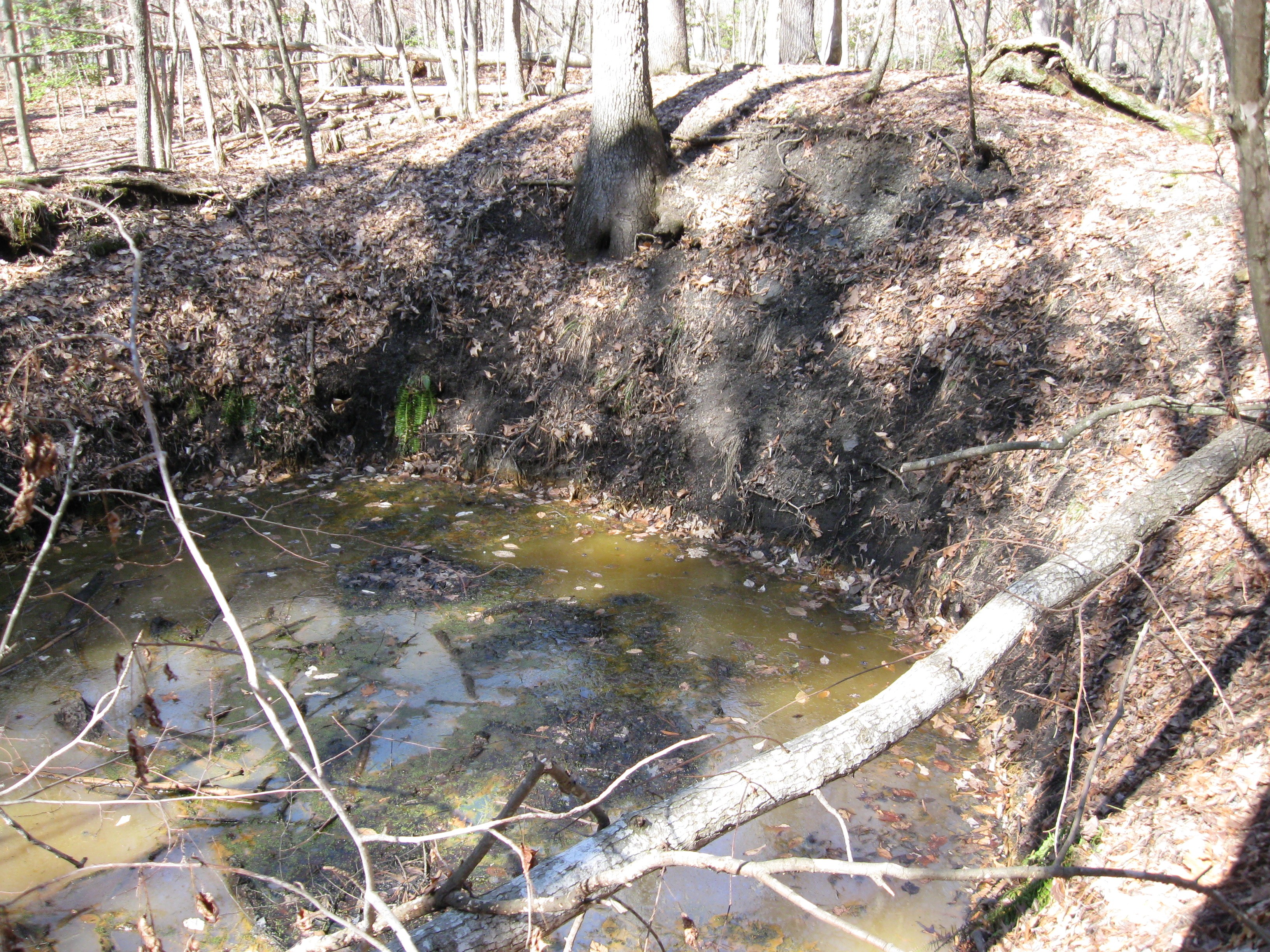
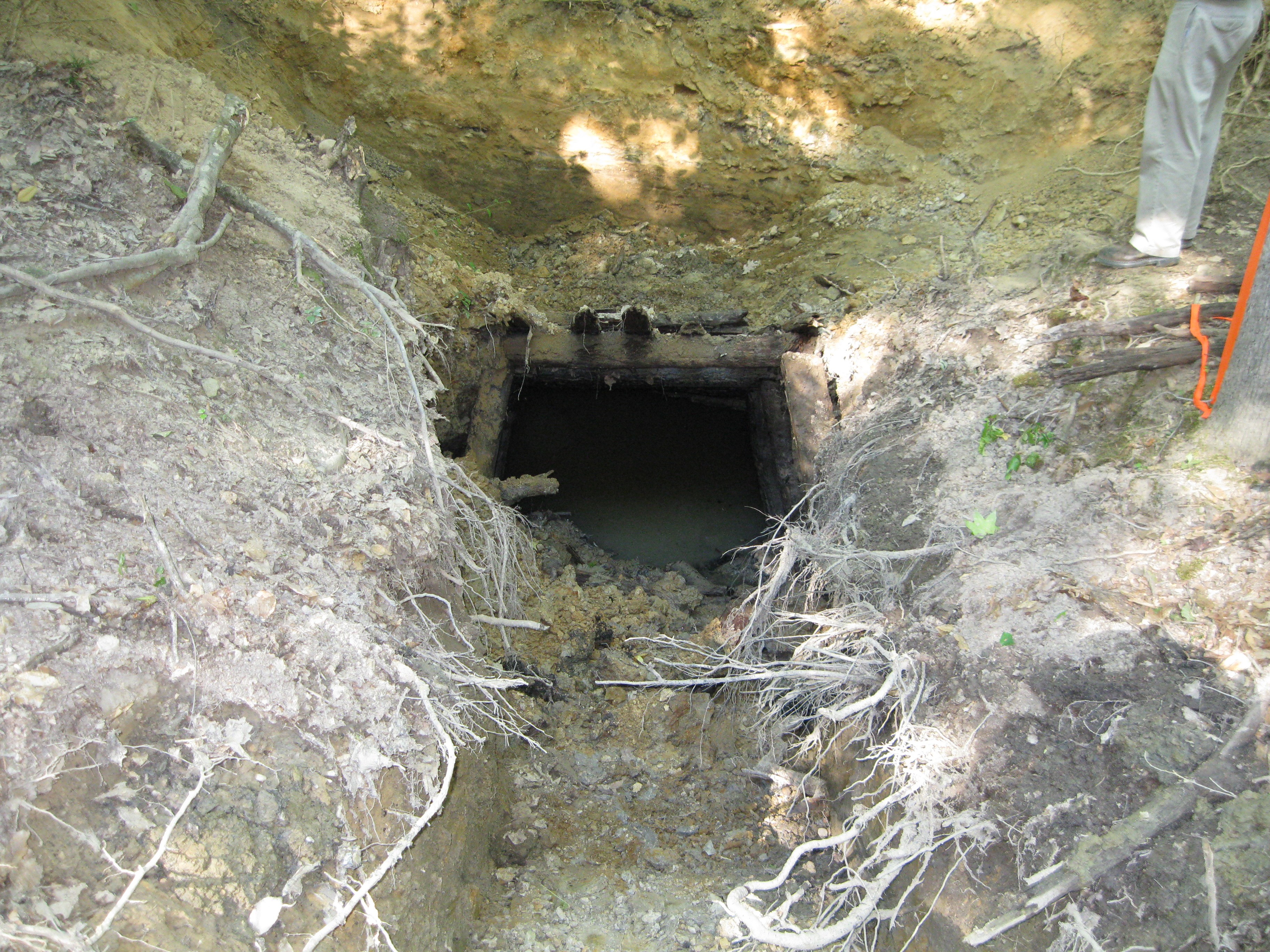
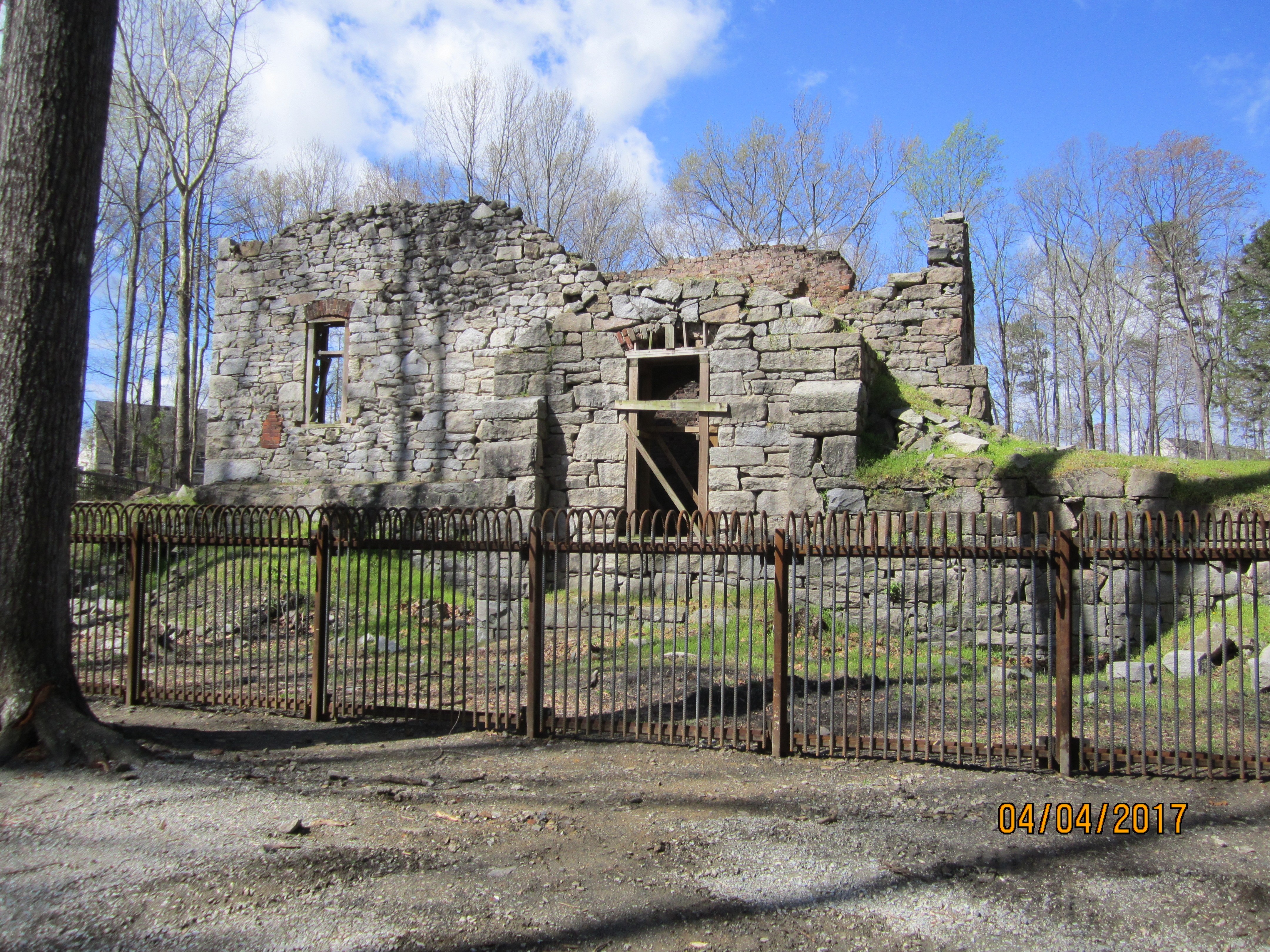
As part of the AML program, AML mapping specialists conduct field work throughout the coal districts of the Richmond area in order to locate and document any types of coal-related features. These features primarily include mine shafts or slopes (referred to as either vertical openings or mine openings), spoil and gob piles, subsidence areas, relict structures (boiler housings, railroad remnants, wingwalls for railroad trestles, etc.), and hazardous water features. Using ESRI's Survey123 app, mapping specialists collect the locational data and special characteristics of each feature. The data is then uploaded into a database that keeps track of all AML inventory features throughout the state, which is available to the public as an interactive map (linked above). The data is also uploaded into a federal database maintained by OSMRE (Office of Surface Mining and Reclamation Enforcement). Data uploaded into the federal system helps support the need for and justification of receiving federal funds for reclamation.
Reclamation
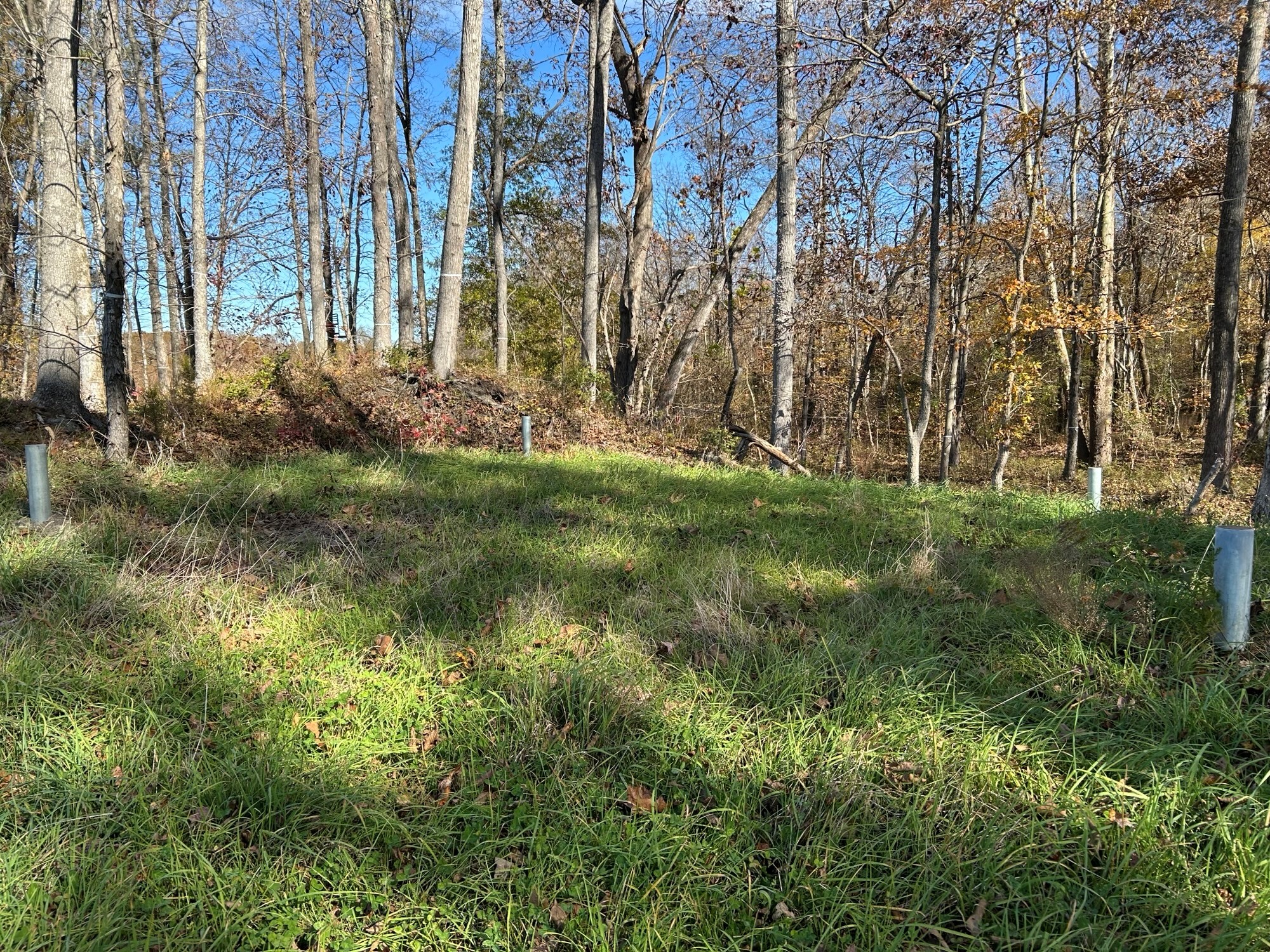
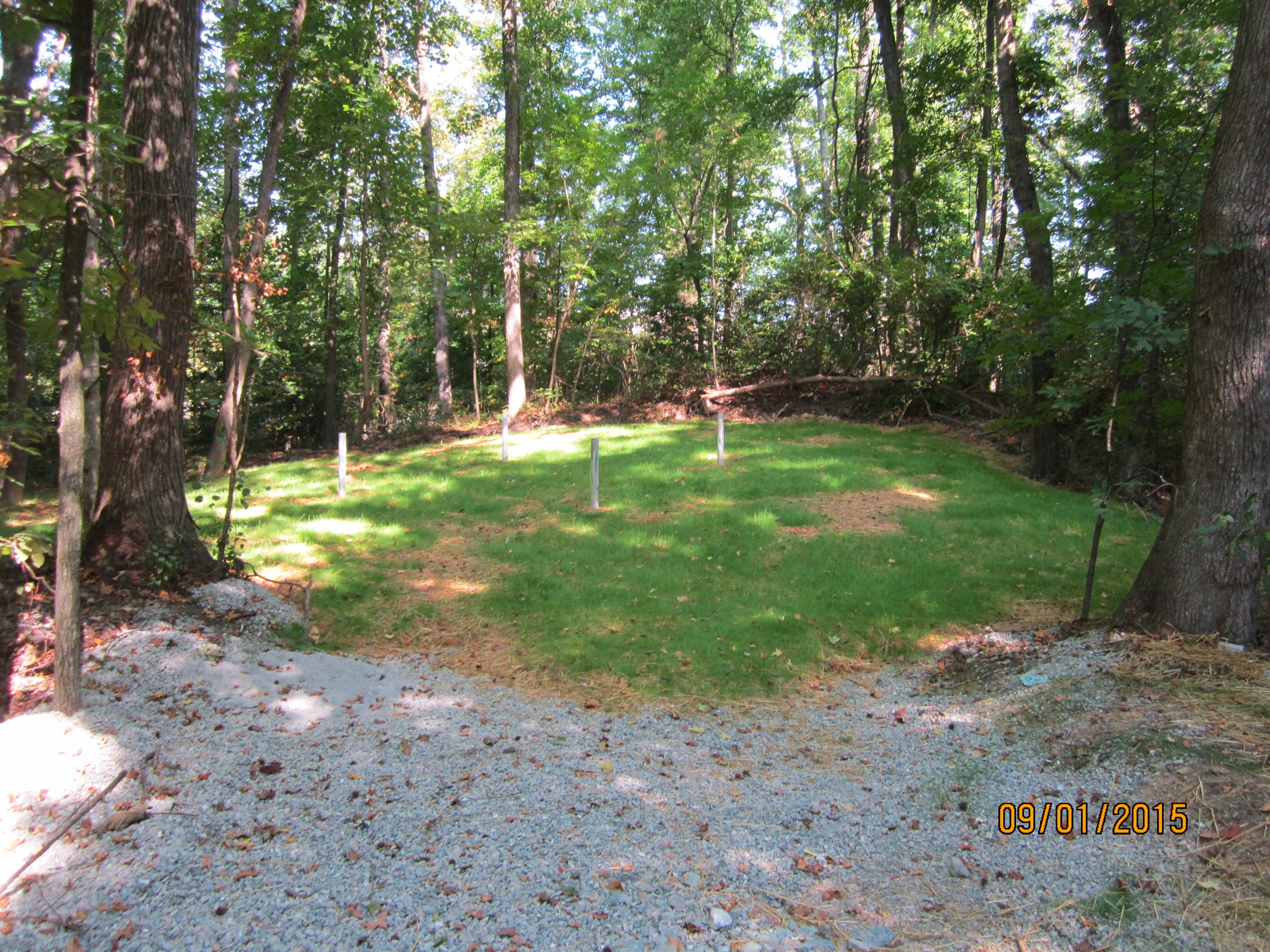
The most important service of the AML program is the elimination of any abandoned mine related hazards through reclamation. If a feature is considered hazardous to public safety or the environment, federal funding is granted to permanently fix the feature, which is a process known as reclamation. In the Richmond area, reclamation typically involves filling in and capping large, deep vertical openings. Although there are several ways to reclaim these vertical openings, the most common method is by excavating around the mine opening, pouring stone into the shaft until it is filled to near the ground surface, then either capping the shaft with concrete or creating a plug with a mixture of grout and stone. Though this fix is considered permanent, four metal posts are typically affixed around the edges of the concrete to mark the location of the mine for public awareness.
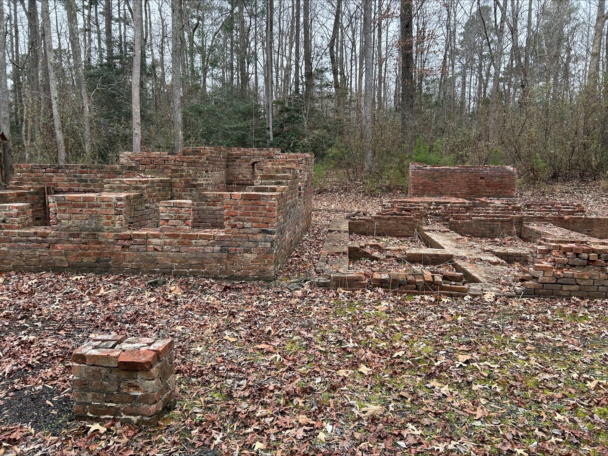
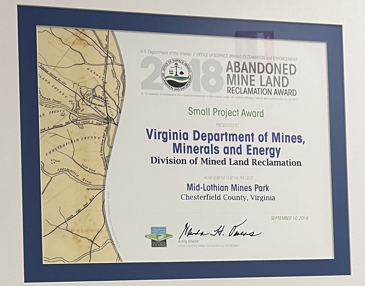
The Midlothian Mines Park, located off Woolridge Road in Midlothian, is one of VA Energy's crowning reclamation achievements in the Richmond area. In partnership with Chesterfield County and the Midlothian Mines and Railroads Foundation, VA Energy and Schnabel Engineering reclaimed two historic vertical openings, five subsidence features, and the remnants of several mining structures. This collaborative reclamation effort removed hazards to the public while also preserving unique mining features, which will allow future generations to get a glimpse of Midlothian's coal mining past in this historic park. This project won the 2018 OSMRE (Office of Surface Mining and Reclamation Enforcement) Small Project Award. News Release for 2018 OSMRE Small Project Award
Funding for reclamation projects comes from money allocated through the federal Infrastructure Investment and Jobs Act (IIJA). For more information on IIJA and reclamation funding, please visit our website HERE
Investigations
Another aspect of the AML program involves responding to citizen concerns. If a citizen in an area with known or suspected coal mining observes a feature, such as a depression in the ground surface, surficial cracking, or an open hole, he or she is encouraged to contact AML. An AML inspector will promptly investigate the complaint and recommend a course of action.
Contact Us
Phone: (276) 523-8100
E-mail:
AbandonedMineInfo@energy.virginia.gov (Mined Land Repurposing)
More Information
If you are interested in learning more, please visit our interactive StoryMap, which gives a detailed timeline and visual history of Richmond's coal mining past, a quick dive into the area's geologic setting, and an in-depth look at the different facets of the AML program in Richmond.
Geology and Mineral Resources Webstore also has multiple publications and maps that may provide additional information about the geology and landscape of the Richmond Triassic Basin, as well as a publication on the history of mining in the Richmond area.