Virginia Energy implemented a Cumulative Hydrological Impact Assessment (CHIA) program. For each new, renewed, or revised coal mining permit Virginia Energy assesses the probable cumulative hydrologic impacts of mining and determines whether the operation has been designed to prevent damage to hydrologic conditions outside the permit area. The CHIA is funded through the Federal Office of Surface Mining (OSM). Geology and Mineral Resources will provide the geological basis for CHIA reports.
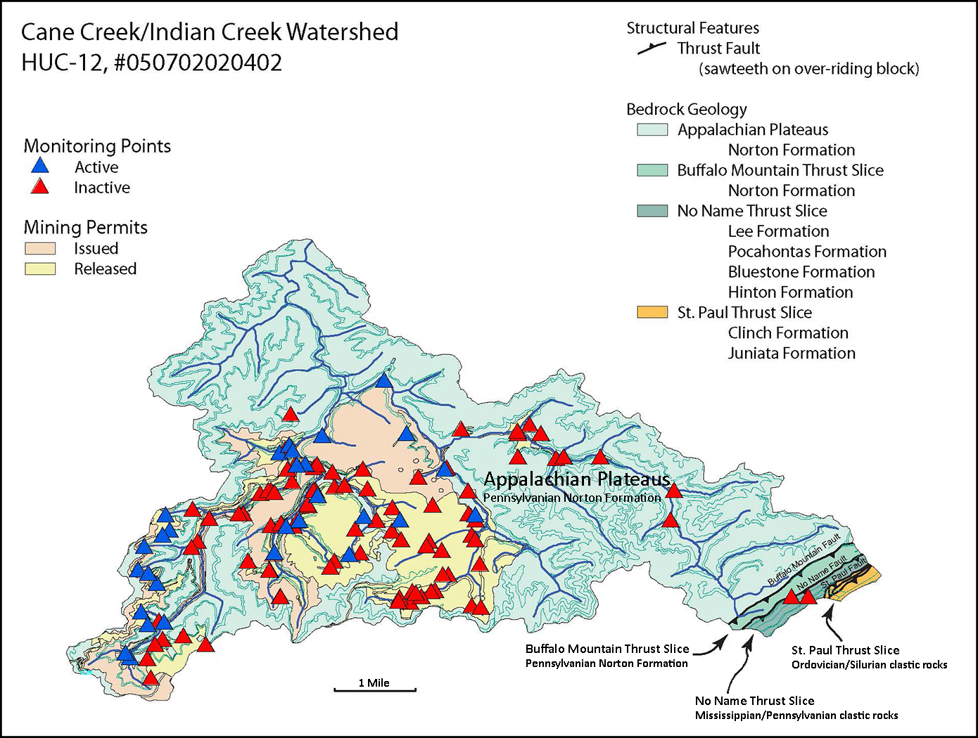
CHIA data is organized by watershed (see map example below), using the Hydrologic Unit Code (HUC) system to identify a unique watershed. Water quality is monitored through the National Pollution Discharge Elimination System (NPDES), a permitting system authorized by the Clean Water Act of 1972 that regulates point sources that discharge pollutants into rivers, streams, or lakes. In most cases this system is administered by individual states. A key factor is the Total Maximum Daily Load (TMDL), a calculation of the maximum amount of a pollutant that a water body can receive and still meet water quality standards, accompanied by the allocation of that load among the various sources of that pollutant. Individual states are responsible for developing TMDLs and submitting them to the EPA for approval.
Geology and Mineral Resources will provide the geological basis for CHIA reports in five phases.
Phase One: Convert the forty-eight digitized geologic maps in the Southwestern Virginia coalfield area into ArcGIS files.
Phase Two: Combine the ArcGIS files into a single geodatabase. Address mapping and digitizing errors, such as map edge match offset, and standardize graphic representations for the various geological formations.
Phase Three: Create an idealized, composite stratigraphic column that characterizes the different formations in terms of:
- Hydrological characteristics such as porosity, permeability, and transmissivity
- Geochemical characteristics with regard to acid-forming minerals (eg. pyrite)
- Physical characteristics such as slake durability (a qualitative estimate of rock deterioration over time) suggesting potential yield of Total Dissolved Solids (TDS)
Phase Four: Expand the computer model:
- Create surfaces for tops and bases of geologic formations
- Incorporate geologic cross-sections
- Develop 3-D visualizing capabilities
Phase Five: Add in DMLR GIS data, including:
- HUC-12 Sub-watershed boundaries
- Mine extents and permit boundaries
- Land use
- NPDES discharge points, surface water monitoring, and groundwater monitoring stations
- Well data
Web sites: