HyperLink
Sign In Sign In Sign Out Logout Account Account Cart Cart
 
  SEARCH    Help?         Why do we use cookies?       Privacy Policy/Disclaimer
    Home

SURVEY

Product Categories


Sales & Returns Policy


Spacer Image

Spacer Image
Spacer ImageReport of Investigations 039: Bouguer gravity in southeastern Virginia
Spacer Image Spacer Image
Spacer ImageIn Stock
Spacer ImageYour Price: $6.00
Spacer ImageModel Number: 1207

Spacer Image
Spacer Image
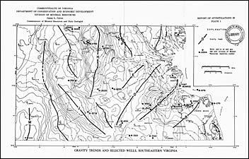
by S.S. Johnson, 42 pages, 2 maps (1 in color), 1 figure, 1 table, 1975, The area of this gravity report consists of approximately 6,800 square miles in Virginia, extending from 78 degrees west longitude east to the Atlantic Ocean and Chesapeake Bay and from 37 degrees, 30 minutes north latitude south to the Virginia-North Carolina boundary. The survey included areas in the Piedmont and Coastal Plain physiographic provinces. Gravity methods are used predominantly in regional surveys to help determine the location of anomalous areas that may be further investigated by geological and other geophysical techniques. Correlation was found to exist between the gravity anomalies and geological structure.
 Customers who bought this also bought
  Report of Investigations 032: Bouguer gravity, northeastern Virginia and the Eastern Shore peninsula
  Publication 035: Geology of the Villamont and Montvale Quadrangles, Virginia
  Publication 071: Geology of the Virginia Portion of the Flat Gap Quadrangle
  Publication 167: Selected Karst Features of the Southern Valley and Ridge Province, Virginia
  Publication 065: Geology of the Norton Quadrangle, Virginia
 
Spacer Image