HyperLink
Sign In Sign In Sign Out Logout Account Account Cart Cart
 
  SEARCH    Help?         Why do we use cookies?       Privacy Policy/Disclaimer
    Home

Product Categories


Sales & Returns Policy


Spacer Image

Spacer Image
Spacer ImageReport of Investigations 011: Geology of the Leesburg quadrangle, Virginia
Spacer Image Spacer Image
Spacer ImageIn Stock
Spacer ImageYour Price: $6.00
Spacer ImageModel Number: 1179

Spacer Image
Spacer Image
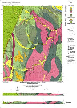
by E.C. Toewe, 52 pages, map in color, 14 figures, 6 tables, 1966. Map shows the geology and mineral resources of the Leesburg 7.5-minute quadrangle. The Leesburg quadrangle is located in Loudoun County in northern Virginia. It is within both the Piedmont and Blue Ridge physiographic provinces. The rocks of the area include Precambrian or Cambrian metabasalt, Cambrian quartzite, Triassic conglomerate, sandstone, shale, pyroclastic rock, diabase and basalt. Crushed diabase is produced for use as road aggregate in the area. Map includes cross-sections.
 Customers who bought this also bought
  Report of Investigations 005: Geology of the Clinchport quadrangle, Virginia
  Clinchport, VA Topographic Map (1:24,000)
  Report of Investigations 037: Geology of the Salem Quadrangle, Virginia
  Salem, VA Topographic Map (1:24,000)
  Leesburg, VA-MD Topographic Map (1:24,000)
 
Spacer Image