HyperLink
Sign In Sign In Sign Out Logout Account Account Cart Cart
 
  SEARCH    Help?         Why do we use cookies?       Privacy Policy/Disclaimer
    Home

Product Categories


Sales & Returns Policy


Spacer Image

Spacer Image
Spacer ImageOpen File Report 20-03 Geologic Map of the west half of the Hopewell Quadrangle
Spacer Image Spacer Image
Spacer Image
Spacer ImageYour Price: $0.00
Spacer ImageModel Number: 3089

Spacer Image
Spacer Image
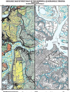
By M.E. Occhi, 36 x 50-inch color 1:24,000-scale geologic map, 2020. This map of the west half of the Hopewell 7.5-minute quadrangle in Chesterfield, Prince George counties, and the cities of Colonial Heights and Hopewell, Virginia shows the distribution of Mesozoic and Cenozoic-age sedimentary rocks in map and cross-section. Surficial deposits including alluvium are also shown. Online only.
Spacer Image