HyperLink
Sign In Sign In Sign Out Logout Account Account Cart Cart
 
  SEARCH    Help?         Why do we use cookies?       Privacy Policy/Disclaimer
    Home

Product Categories


Sales & Returns Policy


Spacer Image

Spacer Image
Spacer ImageOpen File Report 15-04 Geologic Map of the Salisbury Quadrangle
Spacer Image Spacer Image
Spacer Image
Spacer ImageYour Price: $0.00
Spacer ImageModel Number: 3064

Spacer Image
Spacer Image
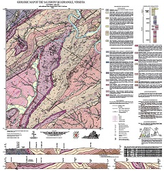
By M.J. Heller, 33 x34-inch color 1:24,000-scale geologic map, 2015. This map of the Salisbury 7.5-minute quadrangle in Botetourt County, Virginia shows the distribution of Paleozoic-age sedimentary rocks in map and cross-section. Surficial deposits including alluvium. fans, and river terraces are also shown. Online only.
Spacer Image