
|
Your Price: $0.00
Model
Number: 3063
|
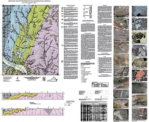
By N.H. Evans and S.S. Farrar, 41 x 50-inch color 1:24,000-scale geologic map, 2015. This map of the Perkinsville 7.5-minute quadrangle in Goochland, Hanover, Louisa, and Powhatan counties, Virginia shows the distribution of Mesozoic-age igneous rock, and Proterozoic-age igneous and metamorphic rocks in map and cross-section. Surficial deposits including alluvium and terraces are also shown. A brief report accompanied by 20 figures and 1 table describes the local geology. Online only.
|
|