
|
Your Price: $0.00
Model
Number: 2643
|
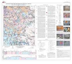
by M.W. Carter, A.K. Bondurant, and C.R. Berquist, Jr., 36- x 42-inch color 1:24,000-scale geologic map, 2010. This map of the Chesterfield 7.5-minute quadrangle in Chesterfield County, Virginia shows the distribution of Paleozoic igneous and metamorphic rocks, Mesozoic sedimentary rocks, Cenozoic Coastal Plain sediments, and alluvium in map and cross-section. The characteristics of each map unit are described. Mineral resource, boring, and sample locations are also shown on the map. Online only.
|
|