
|
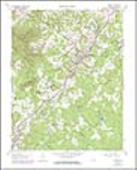
Amherst, VA Topographic Map (1:24,000)
|
|
|
In Stock
Your Price: $8.00
Model
Number: 15

|
USGS 7.5' paper topographic map for Amherst, VA (approximate size: 20 x 27 inches) - Dates: Original 1963, Photorevised 1978
|
|
|
|
Customers who bought this also bought
|
Tobacco Row Mountain, VA Topographic Map (1:24,000)
|
Forks of Buffalo, VA Topographic Map (1:24,000)
|
Buena Vista, VA Topographic Map (1:24,000)
|
Piney River, VA Topographic Map (1:24,000)
|
Buffalo Ridge, VA Topographic Map (1:24,000)
|
|
|
|
|
|