|


 In Stock In Stock
 Your Price: $6.00 Your Price: $6.00
 Model
Number: 1151 Model
Number: 1151
 

|
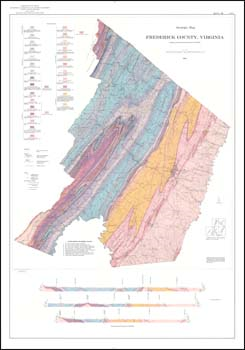
by Charles Butts and R.S. Edmundson, 5.5 x 8.5-inch soft cover book, 142 pages, 6 tables, 27 illustrations, folded 31 x 45-inch color 1:62,500-scale geologic map, folded color 1:24,000-scale generalized structure sections of little North Mountain, 1966. Report outlines the geology and mineral resources of Frederick County, in the Valley and Ridge of Northern Virginia. The southeastern part of the county is underlain by Cambrian and Ordovician limestone and shale. Exposed strata in the northwestern part of the county ranges in age from Late Ordovician to Early Mississippian, and consists mainly of sandstone and shale with minor limestone. Paleozoic asymmetric folds and thrust faults verge northwestward in the southern part of the county, but to the northwest, faults are less common and folds are more open. Manganese, iron, limestone, dolostone, silica sand, clay, and shale are important economic mineral resources in the county.
|
|