
|
Your Price: $0.00
Model
Number: 3070
|
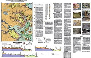
By M.E. Occhi, J.S. Blanchette, and C.R. Berquist, Jr., 36 x 55-inch color 1:24,000-scale geologic map, 2017. This map of the Chester 7.5-minute quadrangle in Chesterfield County, Virginia shows the distribution of Cenozoic-age unconsolidated sediments and Paleozoic-age igneous rocks in map and cross-section. Alluvium and modified land are also shown. A brief report accompanied by 7 figures describes the local geology. Online only.
|
|