HyperLink
Sign In Sign In Sign Out Logout Account Account Cart Cart
 
  SEARCH    Help?         Why do we use cookies?       Privacy Policy/Disclaimer
    Home

Product Categories


Sales & Returns Policy


Spacer Image

Spacer Image
Spacer ImageOpen File Report 05-05 Preliminary Surficial Geologic Map of the Grottoes quadrangle
Spacer Image Spacer Image
Spacer Image
Spacer ImageYour Price: $0.00
Spacer ImageModel Number: 2638

Spacer Image
Spacer Image
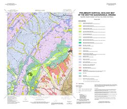
by H. Mills, E.V.M. Campbell, J. Floyd, H. Hibbitts, and S. Williams, 30- x 35-inch color 1:24,000-scale geologic map, 2005. This preliminary map is derived from USDA Soil data and reconnaissance field mapping. It shows the general distribution of surficial deposits including alluvium, alluvial fans, mountain slope colluvium, and residuum derived from bedrock. Only available online.
Spacer Image