
|
In Stock
Your Price: $7.00
Model
Number: 1106

|
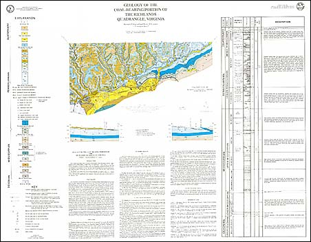
by K.J. Englund and B.A. Couzens, color map with map text, one-sheet, scale 1:24,000, 1991. Map shows the geology and mineral resources of the coal-bearing portions of the Richlands 7.5-minute quadrangle. Richlands quadrangle is located in the southwestern part of Virginia in Tazewell and Russell counties. The mapped portion of the quadrangle is within the Appalachian Plateaus and Valley and Ridge physiographic provinces and is characterized by steep-sloped ridges and narrow valleys. The bedrock in this quadrangle ranges in age from Lower to Middle Pennsylvanian. The rocks are primarily interbedded siltstones, sandstones, and shales. The dominant structure in the map area is the southwestward plunging Dry Fork anticline. Coal is the primary mineral/energy resource in the map area. It occurs in 50 beds of which approximately 25 are of sufficient thickness to be considered a resource. Map includes cross-section.
|
|