
|
Publication 016: Geology of the Abingdon, Wyndale, Holston Valley, and Shady Valley Quadrangles
|
|
|
In Stock
Your Price: $6.00
Model
Number: 1008

|
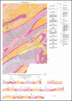
by C.S. Bartlett, Jr. and T.H. Biggs, 8.5 x 11-inch soft-cover book, 39 pages, 2 plates include folded 29 x 40-inch (approximate size) color 1:24,000-scale geologic maps, 16 figures, 6 tables, 1980. Geologic map and accompanying text describe the stratigraphy, structure, economic geology, and environmental geology of the Abingdon and Wyndale 7.5-minute quadrangles and the Virginia portions of the Holston Valley, and Shady Valley 7.5-minute quadrangles in Washington County. Valley and Ridge sedimentary rocks and recent alluvium and colluvium are delineated on the geologic map with cross-sections. Inactive quarries and prospects for crushed stone, limestone, shale and iron are depicted. Also shown are rock, fossil and sample repository and measured section locations. The results of chemical and engineering analyses of carbonate rocks and several stratigraphic sections are included in the report.
|
|
|
|
|
|
|