Topographic maps use contour lines (lines of equal elevation) to show the shape and elevation of the land. Topographic map features commonly include mountains, valleys, rivers, lakes, plains, vegetation, roads, railroads, political boundaries, and buildings.
Geology and Mineral Resources stocks a variety of scales of topographic maps covering Virginia. The most detailed of these are the 7.5-minute topographic maps with woodland coverage. The scale of these maps is 1:24,000 or 1 inch = 2,000 feet, and each map is approximately 20 inches by 27 inches.
These topographic maps are available for purchase through the Web Store .
7.5-minute (1:24,000 scale) topographic map index
30-minute x 60-minute (1:100,000 scale) topographic map index
County topographic map index (1:50,000)
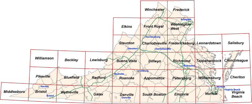
30-minute x 60-minute (1:100,000 scale) Map Index
Click on an area below to purchase 30-minute x 60-minute (1:100,000 scale) topographic maps. Each map is approximately 41 inches by 24 inches.
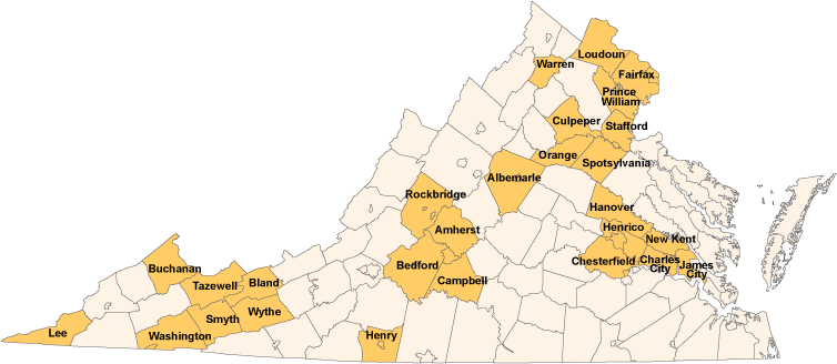
Virginia County Map Index (1:50,000 scale)
Click on an area below to purchase county topographic maps (1:50,000 scale).
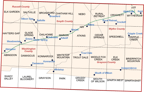
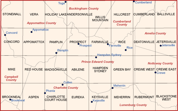
7.5-minute (1:24,000 scale) Topographic Map Index
Click on a county below to zoom in to see the locations and names of the 7.5-minute (1:24,000 scale) topographic maps. Each map is approximately 20 inches by 27 inches.
Appomattox
Return
Beckley
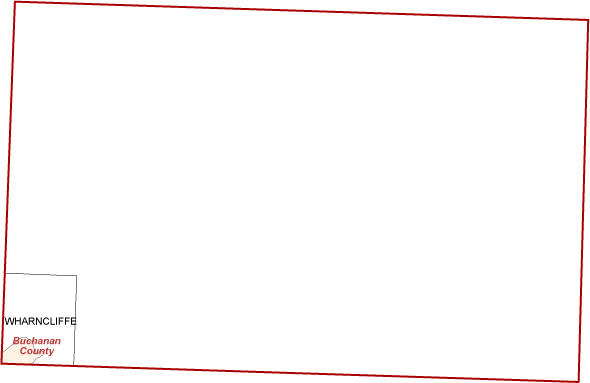
| Wharncliffe |
Return
Bluefield
Return
Bristol
Return
Buena Vista
Return
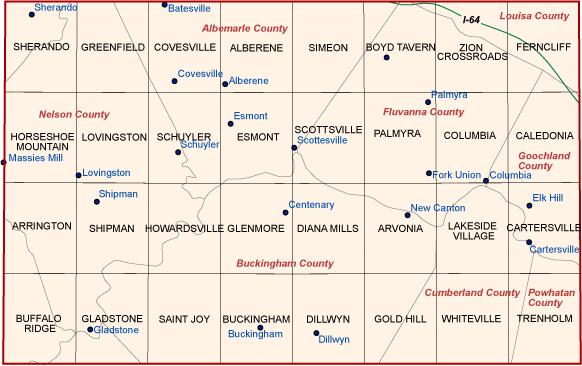
Charlottesville
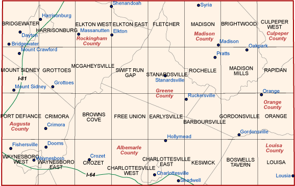
Return
Cheriton
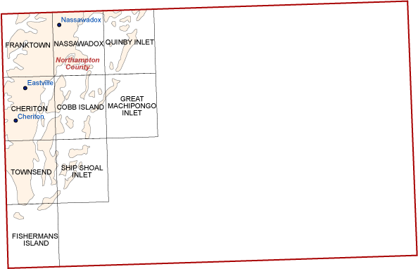
| Cheriton | Franktown | Quinby Inlet |
| Cobb Island | Great Machipongo Inlet | Ship Shoal Inlet |
| Fishermans Island | Nassawadox | Townsend |
Return
Chincoteague
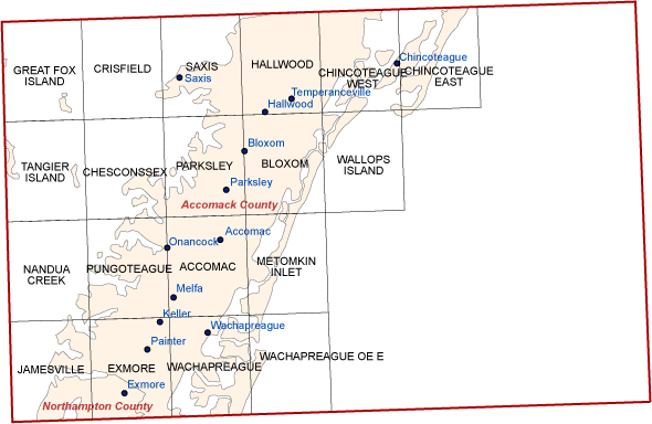
Return
Danville
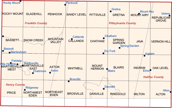
Return
Dillwyn
Return
Elkins
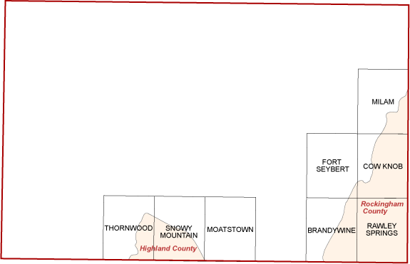
| Brandywine | Milam | Thornwood |
| Cow Knob | Rawley Springs | |
| Fort Seybert | Snowy Mountain |
Return
Emporia
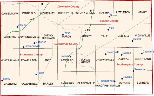
Return
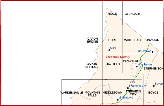
Frederick
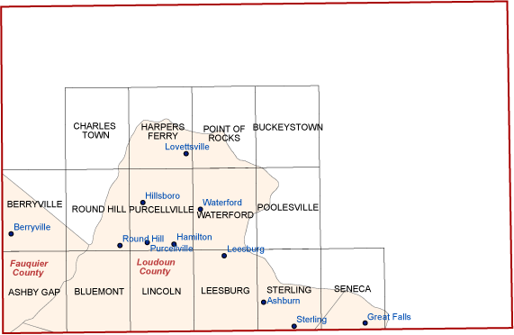
| Ashby Gap | Harpers Ferry | Purcellville |
| Berryville | Leesburg | Round Hill |
| Bluemont | Lincoln | Seneca |
| Buckeystown | Point of Rocks | Sterling |
| Charles Town | Poolesville | Waterford |
Return
Fredericksburg
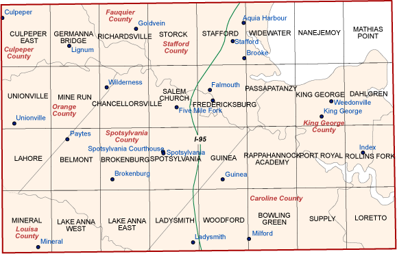
Return
Front Royal
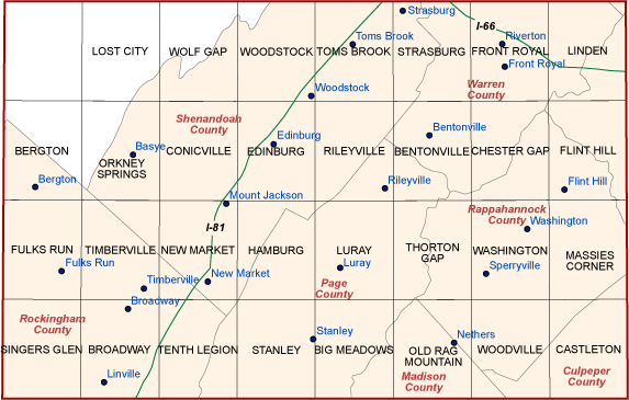
Return
Galax
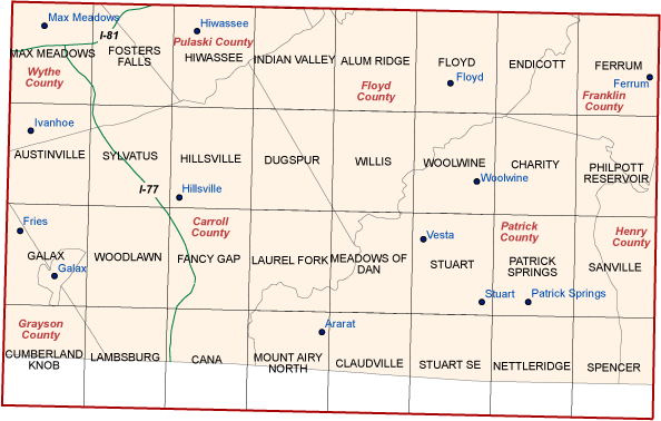
Return
Leonardstown
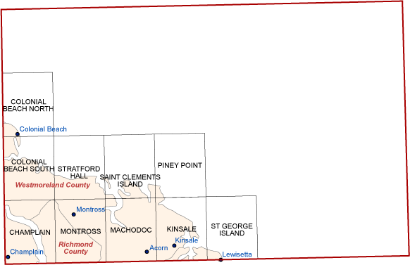
| Champlain | Machodoc | St George Island |
| Colonial Beach North | Montross | Stratford Hall |
| Colonial Beach South | Piney Point | |
| Kinsale | Saint Clements Island |
Return
Lewisburg
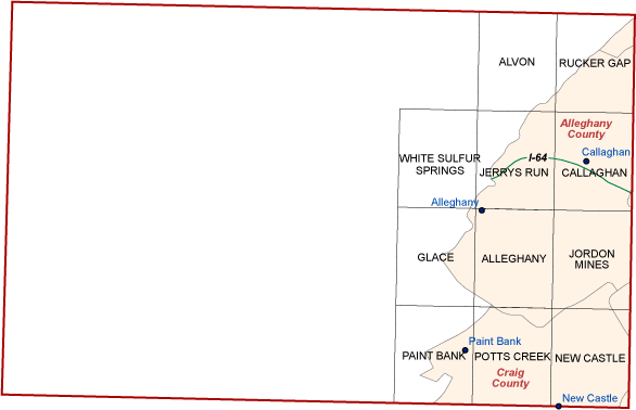
| Alleghany | Jerrys Run | Potts Creek |
| Alvon | Jordon Mines | Rucker Gap |
| Callaghan | New Castle | White Sulfur Springs |
| Glace | Paint Bank |
Return
Middlesboro
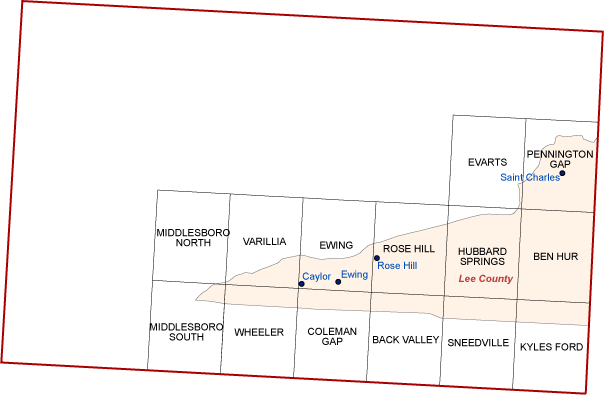
| Back Valley | Hubbard Springs | Rose Hill |
| Ben Hur | Kyles Ford | Sneedville |
| Coleman Gap | Middlesboro North | Varilla |
| Evarts | Middlesboro South | Wheeler |
| Ewing | Pennington Gap |
Return
Norfolk
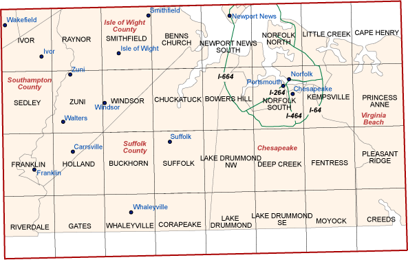
Return
Petersburg
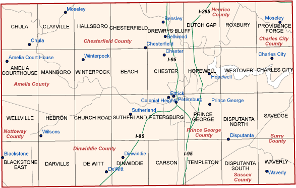
Return
Pikeville
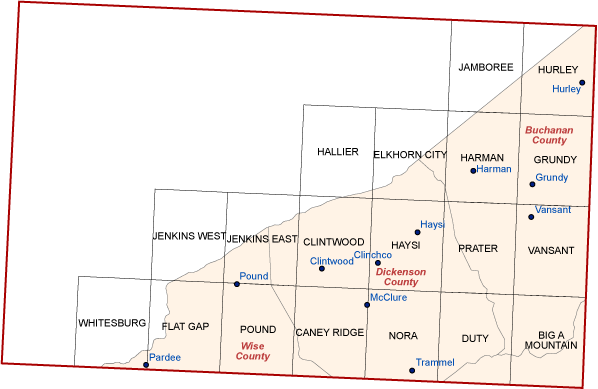
| Big A Mountain | Harman | Nora |
| Caney Ridge | Haysi | Pound |
| Clintwood | Hellier | Prater |
| Duty | Hurley | Vansant |
| Elkhorn City | Jamboree | Whitesburg |
| Flat Gap | Jenkins East | |
| Grundy | Jenkins West |
Return
Radford
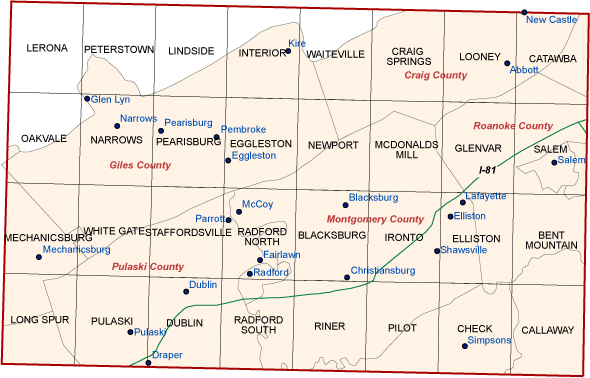
Return
Richmond
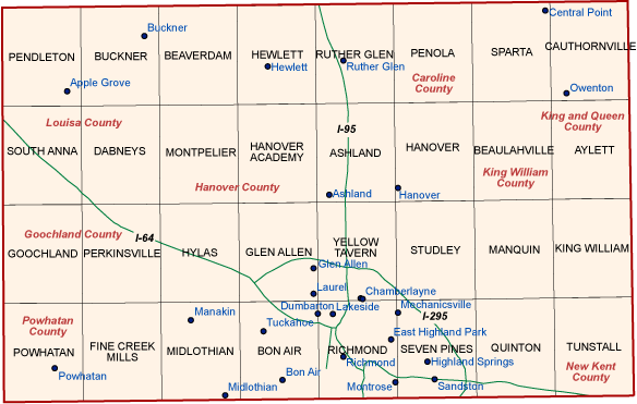
Return
Roanoke
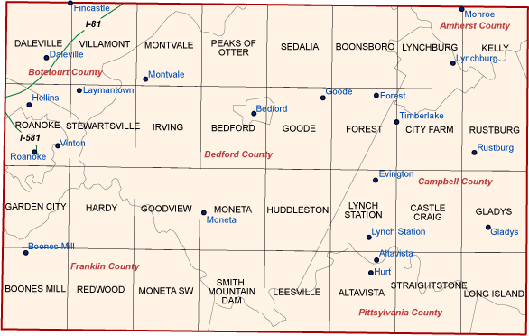
Return
Salisbury
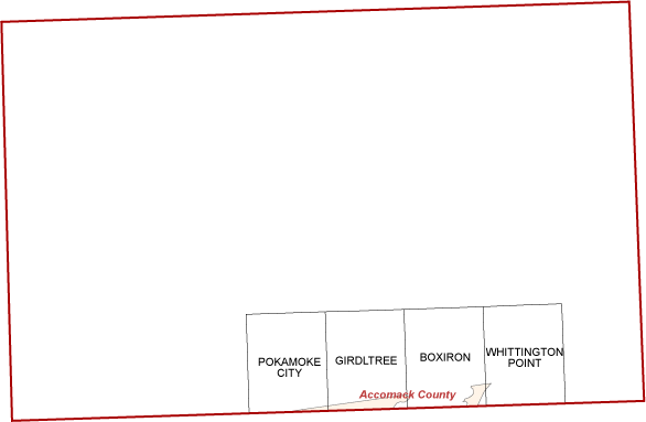
| Boxiron | Whittington Point |
| Girdltree | |
| Pokamoke City |
Return
South Boston
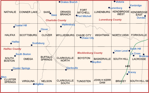
Return
Staunton
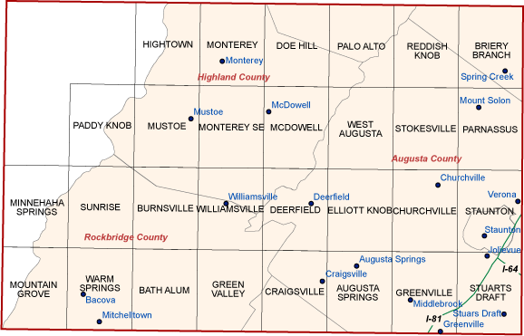
Return
Tappahannock
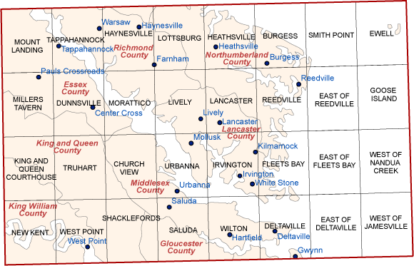
Return
Virginia Beach
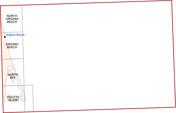
| Knotts Island | Virginia Beach |
| North Bay | |
| North Virginia Beach |
Return
Washington West
Return
Williamsburg
Return
Williamson
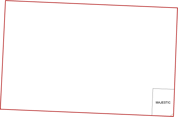
| Majestic |
Return
Winchester
| Boyce | Hayfield | Stephens City |
| Capon Bridge | Inwood | Stephenson |
| Capon Springs | Middletown | Wardensville |
| Glengary | Mountain Falls | White Hall |
| Gore | Ridge | Winchester |
Return
Wytheville